Interstate 4
|
|
||||
|---|---|---|---|---|
_map.svg.png) |
||||
| Route information | ||||
| Maintained by FDOT | ||||
| Length: | 132.30 mi[1][2] (212.92 km) | |||
| Existed: | 1957 – present | |||
| Major junctions | ||||
| West end: | ||||
| East end: | ||||
| Location | ||||
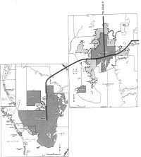
| Counties: | Hillsborough, Polk, Osceola, Orange, Seminole, Volusia | |||
| Highway system | ||||
|
Main route of the Interstate Highway System Florida State and County Roads
|
||||

Interstate 4 (I-4) is a 132.30-mile (212.91 km) intrastate Highway located entirely within the state of Florida, United States. It goes from Interstate 275 in Tampa, Florida () to Interstate 95 at Daytona Beach, Florida (). It also has the Florida Department of Transportation designation of State Road 400, but only a small portion of the route is signed at the east end. I-4 is currently the lowest-numbered Interstate Highway in the contiguous 48 U.S. states. The area that surrounds I-4 is often referred to as the I-4 Corridor.
Contents |
Route description
I-4 maintains a diagonal, northeast-southwest route for much of its length, although it is signed east-west. The 132-mile (212 km) route begins with an interchange with I-275 in Tampa and continues east toward I-75.
After passing through the eastern suburbs of Hillsborough County, it crosses into Polk County, entering the Lakeland area, intersecting with the Polk Parkway twice before entering Polk City.
At this point, the interstate starts a turn toward the northeast where it intersects with the Orlando area cutting the city through at a diagonal direction going northeast/southwest. The route provides access to all of Orlando's theme parks including Disney World and Universal Studios, as well as nearly all of Orlando's toll roads, including Florida's Turnpike. Throughout most of Orange County and Seminole County, I-4 travels in a roughly north–south direction.
Right before the eastern terminus, I-4 switches to a mostly east/west route in order to connect with traffic from and to I-95. At an interchange with I-95 in Daytona Beach, I-4 terminates; however, SR 400 continues eastward into Daytona Beach.
SR 400, unsigned while concurrent with I-4, becomes signed east of I-95. The road extends for three miles (5 km) from the northeast terminus of I-4, on the south side of Daytona International Speedway and Daytona Beach International Airport, to an intersection with U.S. Route 1 (SR 5) in Daytona Beach. Named Beville Road, it runs along the boundary between the cities of Daytona Beach and South Daytona.
History
I-4 was one of the first Interstate Highways to be constructed in Florida, with the first section opening between Plant City and Lakeland in 1959. By early 1960, the Howard Frankland Bridge was opened to traffic, as well as the segment from the Hillsborough Avenue/ US 301 junction in Tampa to Plant City. The stretch from Lake Monroe to Lake Helen, including the original St. Johns River Bridge also opened during that period. The segment from Lakeland to Orlando was complete by 1962. By the mid 1960s, several segments were already complete, including Malfunction Junction in Tampa and parts of I-4 through Orlando. The original western terminus was set in South Pasadena in the late 1960s, but this plan was rejected due to local opposition. As a result, I-4 only went as far southwest as 9th St N in St. Petersburg.
The entire Interstate Highway was completed by the late 1960s, however, the western terminus was truncated to Malfunction Junction in 1971 when I-75 was extended over the Frankland Bridge. Eventually, that stretch was again redesignated to become part of I-275.[3]
In maps and atlases dating to the 1950s, 1960s, and 1970s, The Tampa/St. Petersburg section of Interstate 4/Interstate 275 was marked as the Tampa Expressway. The Orlando segment was marked as the Orlando Expressway. Both names have since faded from maps.
Although many post-1970 interchanges along I-4 were constructed before the recent widening projects, they were designed with I-4 expansion in mind. In other words, there is enough room available to widen I-4 to up to ten lanes without extensively modifying the interchanges. Some of these interchanges include the Interstate 75 stack (constructed in the 1980s) and several interchanges serving the Walt Disney World Resort (constructed in the late 1980s/early 1990s).
In the 2004 U.S. presidential election, the I-4 corridor, a site of significant growth, was a focus of political activity within the swing state of Florida. Communities along the I-4 corridor were perceived by both major political parties as having higher proportions of undecided voters as compared to more Republican- or Democratic-leaning portions of the state. It played an equally key role in the 2008 U.S. presidential election, but whereas the corridor had voted heavily for Bush in 2004, which helped Bush win the state, in 2008 it swung behind Democratic candidate Obama, helping Obama win Florida.[4]
A section of I-4 called the 'dead zone' is rumored to be haunted.[5]
Tampa area
The I-4/I-275 interchange (Malfunction Junction) was rebuilt from 2002 to 2006, and I-4 is under staged renovations to be widened from four to six lanes (with eight lanes in certain segments). Much of this work is complete, and all new travel lanes are now open. Eventually, I-4 will be widened again to a total of at least ten lanes (five in each direction). Studies for this project are already underway and construction should commence sometime in the 2010s. Completion of the project should be around 2020.
Eastbound I-4 shifted to its new, permanent alignment between Malfunction Junction and 50th St on Tuesday, August 8, 2006 at 5:30 am. The new alignment includes a right-lane ramp exit/entry at the 22nd St/21st St Interchange (The previous left-lane configuration was causing hazardous conditions to commuters since its opening in 2005). On Friday, August 11, 2006, a fourth lane opened on eastbound I-4 between the downtown junction and 50th St (led in by a newly opened third lane on the eastbound I-4 ramp from northbound I-275). And on Friday, August 18, the new westbound alignment, just west of 50th Street, opened. The newly opened lanes will improve flow throughout the interchange. The 50th St overpass however, will not be complete until late 2007.[6][7][8][9] Also, the eastbound I-4 exit ramp to Columbus Drive/50th Street is situated to the left-hand side of the highway (as opposed to its former right-hand side exit). This exit shift went into effect in spring 2006 and is part of the new, permanent interstate configuration.
In Tampa, the exit to 40th Street (State Road 569) has been closed since late 2005 due to the ongoing reconstruction of I-4; it will not reopen due to a proposed connector highway with the Lee Roy Selmon Crosstown Expressway.[10]
The interchange with what is today Interstate 75 was constructed in the early 1980s.
Orlando area
As Orlando grew in the 1970s and 1980s, traffic became a growing concern, especially after the construction of the original interchange with the East–West Expressway in 1973, which proved to become a principal bottleneck. The term "highway hostages" was coined in the 1980s to describe people stuck in long commutes to and from Orlando on I-4.
In the early/mid 1990s, several interchanges near Kissimmee were constructed/upgraded to accommodate increasing traffic going to and from Walt Disney World. However, I-4's main lanes were not widened in the process. Around the same time, the Southern Connector was extended to I-4.
The St. Johns River Veterans Memorial Bridge, a two-span six-lane replacement to the original four-lane bridge over the St. Johns River northeast of Orlando, was completed in 2004.
During the early 2000's, tolled express lanes were being planned in the Orlando area as a traffic congestion relief technique for rush hour commuters. The name for them was to be Xpress 400, numbered after the state road designation for I-4, SR 400. The express lanes were slated to extend from Universal Orlando, east to SR 434 in Longwood, and tolls were to be collected electronically via transponders like SunPass and Orlando-Orange County Expressway Authority's E-Pass, with prices dependent on the congestion of the eight main lanes. However, the project was effectively banned by the passage of the SAFETEA-LU Federal transportation bill in 2005, introduced by U.S. Representative John Mica. The plan for tolled express lanes, however, is still in the long term plans for I-4.[11]
The eastbound exit to Robinson Street (State Road 526) permanently closed at 11PM on April 25, 2006, to make way for construction of the new eastbound onramp from State Road 408.[12] The westbound offramp to Gore Street was permanently closed in the same project on 2008-02-11.
The new overpass from I-4 west to John Young Parkway (County Road 423) opened the morning of April 27, 2006.[13][14][15]
2008 Pileup
On January 9, 2008, 70 vehicles were involved in a large pileup on I-4 near Polk City. The pileup was caused by an unexpected thick morning fog that was mixed with a scheduled—and approved—environmental burn by the Florida Wildlife Commission. The fog drifted across I-4, mixing with the smoke, reducing visibility to near-zero conditions. Four people were killed, and 38 were injured. The section of I-4 did not re-open until 6:30 pm the next day, January 10.[16]
Future
Interim improvements to the interchange at State Road 408 were completed at the end of 2008.[17] The rest of the SR 408 improvements are scheduled for the next decade. Intersections at US 192[18] and I-275[19] were completed in 2007. The remaining four-lane segment, from SR 44 to I-95, will eventually be widened to six lanes, with construction anticipated to begin in 2012.[20]
Planning is underway for "ultimate" improvements to Interstate 4 through Orlando from SR 435 (exit 75) east to SR 434 (exit 94).[21] These plans involve adding express lanes to the highway, and the reconstruction of several major interchanges. Construction is scheduled to begin in 2014. Right-of-way procurement alone will top $400 million.[22]
Exit list
| County | Location | Exit # | Destinations | Notes | ||
|---|---|---|---|---|---|---|
| Old | New | |||||
| Hillsborough | Tampa | westbound exit and eastbound entrance | ||||
| 1 | 1 | |||||
| 2 | 2 | Connector under construction as of 2010, scheduled to open in 2013 | ||||
| 3 | 3 | Eastbound left exit, westbound left entrance. Eastbound right entrance and westbound right exit. | ||||
| 4 | 5 | |||||
| 5 | 6 | Orient Road | eastbound exit and westbound entrance | |||
| East Lake-Orient Park | 6 | 7 | Congestion may occur on days when the state fair is on. Traffic delays on the interstate can be common with major tailbacks in either direction. | |||
| 7 | 9 | |||||
| 8 | 10 | [[|]] / Mango Road – Mango, Thonotosassa | ||||
| 9 | 14 | McIntosh Road | ||||
| 10 | 17 | Branch Forbes Road | ||||
| Plant City | 11 | 19 | ||||
| 13 | 21 | |||||
| 14 | 22 | |||||
| 15 | 25 | County Line Road | ||||
| Polk | Lakeland | 15A | 27 | |||
| 16 | 28 | |||||
| 17 | 31 | |||||
| 18 | 32 | |||||
| 19 | 33 | |||||
| 20 | 38 | |||||
| Polk City | 20A | 41 | ||||
| 21 | 44 | |||||
| 22 | 48 | [[|]] – Lake Alfred, Winter Haven | ||||
| 23 | 55 | |||||
| 24 | 58 | [[|]] – Kissimmee, Poinciana | ||||
| Osceola | ||||||
| 24B | 60 | |||||
| Celebration | 24C-D-E | 62 | ||||
| 25A-B | 64A-B | |||||
| 26C-D | 65C-D | Osceola Parkway – Animal Kingdom, Disney's Wide World of Sports Complex | was only 26C eastbound | |||
| Orange | Lake Buena Vista | 26A-B | 67A-B | |||
| 27 | 68 | |||||
| 27A | 71 | Central Florida Parkway – Sea World | eastbound exit and westbound entrance | |||
| Orlando | 28 | 72 | ||||
| 29 | 74A | was 29A westbound after 29B (current 74B) opened | ||||
| 29B | 74B | Universal | westbound exit and entrance | |||
| 30A-B | 75A-B | |||||
| 31 | 77 | |||||
| 31A | 78 | Conroy Road – The Mall at Millenia | ||||
| 32 | 79 | [[|]] (John Young Parkway) | ||||
| 33A-B | 80A-B | |||||
| 34 | 81A | Michigan Street | westbound exit and eastbound entrance | |||
| 35 | 81B-C | Kaley Avenue | was split into 35A and 35B westbound only | |||
| 36 | 82A | |||||
| 37 | 82B | South Street/Anderson Street | South Street: Eastbound exit / Anderson Street: Westbound exit | |||
| 38 | 82C | Anderson Street East | Temporarily Closed for construction of the new Anderson Street Bridge | |||
| 39 | 83 | South Street | westbound exit and eastbound entrance | |||
| 41 | 83B | |||||
| 42 | 84 | Ivanhoe Boulevard | ||||
| 43 | 85 | Princeton Street | Continues as SR438 after the intersection with US 441 | |||
| Winter Park | 44 | 86 | Par Street | eastbound exit and westbound entrance | ||
| 45 | 87 | |||||
| 46 | 88 | |||||
| Maitland | 47 | 90 | split into 90A and 90B eastbound | |||
| Seminole | Altamonte Springs | 48 | 92 | |||
| 49 | 94 | |||||
| Lake Mary | 50 | 98 | Lake Mary Boulevard – Lake Mary, Heathrow | |||
| Sanford | 51A | 101A | [[|]] (Paola Road) – Heathrow | |||
| 101B | ||||||
| 51 | 101C | |||||
| 52 | 104 | |||||
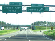
| Volusia | Deltona | 53 | 108 | CR 4162 (Dirksen Drive/DeBary Avenue) – DeBary, Deltona | ||
| 53CA-CB | 111 | CR 4146 (Saxon Boulevard) – Deltona, Orange City | split into 111A and 111B eastbound | |||
| Orange City | 54 | 114 | ||||
| Lake Helen | 55 | 116 | ||||
| 56 | 118 | |||||
| Daytona Beach | 57 | 129 | eastbound exit and westbound entrance | |||
| 58 | 132 | eastbound exit and westbound entrance | ||||
See also
- Hurricane Charley, sometimes referred to as the "I-4 Hurricane"
References
- ↑ "Route Log and Finder List: Table 1". Federal Highway Administration. 2002-10-31. http://www.fhwa.dot.gov/reports/routefinder/table1.cfm. Retrieved 2007-06-07.
- ↑ FDOT GIS data
- ↑ Historic Florida Interstate Information
- ↑ CNN, Candidates eye voters on Florida's I-4, October 11, 2004
- ↑ Ghostly Images Seen, Photographed On 'Deadly' Stretch Of I-4 - Orlando News Story - WKMG Orlando
- ↑ Tampa Bay Interstates, Eastbound I-4 in new alignment, August 8, 2006
- ↑ WTSP, Eastbound I-4 traffic: New lanes, new exit through Ybor City, August 7, 2006
- ↑ WTSP, New I-4 lanes help drivers get to concert early, August 10, 2006
- ↑ Tampa Bay Interstates, New eastbound I-4 lane open!, August 8, 2006
- ↑ Tampa Bay Interstates, I-4/Crosstown Connector Project Page
- ↑ [1]
- ↑ Central Florida News 13, On The Move, April 25, 2006
- ↑ Orlando Sentinel, Rising above I-4 crowds, April 26, 2006
- ↑ WESH, Changes Under Way On I-4, April 26, 2006
- ↑ Central Florida News 13, On The Move, April 26, 2006
- ↑ Interstate 4 has reopened in both directions - Bay News 9
- ↑ I-4 Trans4mation (FSTR 408 Interchange Project)
- ↑ US 192 Interchange_Project Overview
- ↑ MyTBI - Construction Projects - I-4/I-275 Interchange (operational improvements, completed December 2006)
- ↑ Volusia County road construction projects from Florida DOT
- ↑ Kirkman Road to SR 434_Project Overview
- ↑ Orange County road construction projects from Florida DOT
External links
Interstate 4 travel guide from Wikitravel
- Tampa Bay Interstates (Tampa-area reconstruction)
- I4Polk.com (Lakeland-area reconstruction)
- Trans4mation (Orlando-area reconstruction)
| Main Interstate Highways (major interstates highlighted) | |||||||||||||||||||
|---|---|---|---|---|---|---|---|---|---|---|---|---|---|---|---|---|---|---|---|
| 4 | 5 | 8 | 10 | 12 | 15 | 16 | 17 | 19 | 20 | 22 | 24 | 25 | 26 | 27 | 29 | 30 | |||
| 35 | 37 | 39 | 40 | 43 | 44 | 45 | 49 | 55 | 57 | 59 | 64 | 65 | 66 | 68 | 69 | ||||
| 70 | 71 | 72 | 73 | 74 | 75 | 76 (W) | 76 (E) | 77 | 78 | 79 | 80 | 81 | 82 | ||||||
| 83 | 84 (W) | 84 (E) | 85 | 86 (W) | 86 (E) | 87 | 88 (W) | 88 (E) | 89 | 90 | |||||||||
| 91 | 93 | 94 | 95 | 96 | 97 | 99 | H-1 | H-2 | H-3 | ||||||||||
| Unsigned | A-1 | A-2 | A-3 | A-4 | PRI-1 | PRI-2 | PRI-3 | ||||||||||||
| Lists | Primary | Main - Intrastate - Suffixed - Future - Gaps | |||||||||||||||||
| Auxiliary | Main - Future - Unsigned | ||||||||||||||||||
| Other | Standards - Business - Bypassed | ||||||||||||||||||
|
|||||||||||||||||
|
|||||